Saturday, June 29, 2013

Denver

Lisa and I are not generally city dwellers when we take road trips. We usually camp at state and national parks whenever possible and that keeps us away from urban areas. Today was a little bit different though since we ended up in downtown Denver for the day. I suppose that a road-trip through Colorado wouldn't be complete without some time spent in its largest city.

Our first stop was at the Denver Museum of Nature and Science where we toured exhibits on space, mummies, wildlife of North America, gems and mining. It was an extensive collection and we could have easily spent a week within the museum walls and not seen every part of each exhibit. It was the first time that Lisa and I had seen a mummy in its linen wrappings - gross.

For the afternoon, we headed to Coors Field and picked up tickets for the afternoon baseball game. Unlike our major league ballparks on the east coast, we were able to find an affordable ticket on the day of the game. There were plenty of hits and few runs as the Colorado Rockies beat the San Francisco Giants with a run in the bottom of the ninth (with two outs!).


Heading up the road, we're staying in Louisville tonight intending to camp in Rocky Mountain National Park for the next few nights.


Friday, June 28, 2013

Aspen, Leadville and Fossils

Aspen is the worst place. We knew immediately by the amount of signage, the number of private jets in their airport and the perplexity of their municipal parking policy that we would not be fitting in. After walking by the Prada and Ralph Lauren stores we found a $200 pair of jeans outside another shop....and that looked like their sale rack...

The situation became absurd when we noticed that the town offers valet parking on the streets. We buckled over in laughter when we noticed a sign warning that winter conditions may exist on a playground. We skipped down the pedestrian mall after seeing a sign that instructed us to walk. It is apparent that the town is administered by those used to micro-managing individual's behavior. Sadly, what may have once been a nice skiing town has turned into a strip of glamour shopping for the one percent of the one percent.

On the positive side, we did find some delicious (and expensive) ice cream and headed for a forest service campground on the Independence Pass road. The campground was aptly named "Difficult."

 We intended to explore Aspen but it seemed too difficult to get around without spending an entire offshore bank account so we decided to head east over Independence Pass, the highest paved pass in North America!

We met some geology majors from Dartmouth working at the ghost town of Independence for the summer. It was a picturesque community, which originally served as a silver mining town at 10,900 feet! Lisa was happy to see prairie dogs...or were they yellow-bellied marmots?


We continued over to the summit of the pass and stretched our legs at the 12,000 foot paths. Since we were above the treeline, we had ample opportunity to enjoy the view.


On the other side of the mountains, we arrived in Leadville and breathed a sigh of relief to be in a much more reasonable community. The architecture of the town reminded us of Port Henry, New York which also had a mining heyday around the turn of the 20th century. We parked on the street (for free) and wandered around the town, learning some tidbits of local history. In the evening, we visited the Silver Dollar Saloon, which has been a fixture in the town since 1879. Armed with our cribbage board, we spent the night playing cards and tickling the ivories (the few that were left) on the saloon piano.


We camped at the Silver Dollar campground, a forest service site which was fairly mosquito-infested so we hid in the tent and packed up quickly the next morning.

Since we didn't want to cook breakfast among the insects, we headed to the Golden Burro Diner for french toast. Holding our sides as we left, we meandered south along the Arkansas River Valley.

Crossing over two easy mountain passes, we arrived in Florissant, home of the Florissant Fossil Bed National Monument. We were surprised to see that the park contains some of the largest fossils that we have ever seen: fossilized redwood stumps. These were the result of volcanic mud flows which preserved the bottoms of the trees while the tops died and rotted away. This impressive petrified forest is not the main focus of scientists, for there are incredibly well-preserved insect, fish and plant fossils among the shale deposits in the area which date to the Eocene period (roughly 34 million years ago), when the climate was warmer and more humid.

Petrified Redwood Stump
Flutterby!

Continuing east, we stopped for a peek at the Garden of the Gods in Colorado Springs. We walked among the large vertical sandstone monoliths and admired Pikes Peak in the distance. Some of the area was bustling, but a short walk brought us to solitude (or duatude?).

Defying Gravity...
Garden of the Gods

We struck out on finding open camping for the evening, so we grabbed a hotel room in Castle Rock. Tomorrow we will be heading into Denver to explore!

Wednesday, June 26, 2013

Moab and Grand Junction

As expected, Moab was hot. After stopping in town, we headed directly to Arches National Park, which is only a few miles north. We had been there before, but had not spent as much time as we would have liked. We had also forgotten how popular the park was when we found packed tour buses at the visitor center and a campground with no vacancies.

We made some chicken sandwiches with Arby’s sauce at the picnic area and headed back to the Park Avenue Trail for our only hope of a shady hike. With the towering monoliths on either side, we were able to have a temperate walk, with massive sandstone sculptures at which to stare.


The nearest state park was also full, so we started to drive northeast on the road that follows the Colorado River until we found an empty Bureau of Land Management campground called “Upper Drinks.” I think that we found the only shady campsite in Moab with pinyon pines and scrubby oaks surrounding us. A path led down to the river where we dipped our feet and sat for the afternoon. We also played some music, which ended with a bird pooping on Lisa’s guitar…obviously not a songbird.


Looking for something cold to drink, we headed back into town and found malts! We sipped them while wandering down the shady side of the street before we headed back to our campsite for an early night.

We awoke at 4:30 the next morning intending to hike to delicate arch, the unofficial Utah state symbol. It is an incredibly popular destination and we wanted to beat the crowds and the heat. We arrived at the trailhead as the sun was rising and enjoyed a comfortable hike into the arch. There were only a handful of visitors and we enjoyed the view until the arch was in full sun.

A National Oddity

Looking up at Delicate Arch
When we returned the sun was getting higher in the sky and the heat was getting more intense. We decided to head east since we knew that a heat wave was coming and as Vermonters, we are not really used to sunshine for more than twenty minutes at a time. We grabbed a hotel room in Grand Junction and spent the rest of the day lounging around.

The next morning, we headed to the lower monument trailhead at Colorado National Monument. We hiked to Independence Monument and looked up at the view that we saw from the campground three years earlier. When we climbed onto a rock for a picture, we saw words chipped onto the flat face of the stone, an odd mystery.


With the sun getting higher in the sky, we downed some water and headed back to the car with our shirt collars raised over our necks. The high temperature in this area would be in the hundreds for the next few days and as much as we would like to spend more time exploring Moab and Grand Junction, the heat is rather stifling.


We grabbed some burritos smothered with green chili sauce in downtown Grand Junction and we are currently climbing in elevation on I-70, heading towards Aspen. The high temperatures in the mountains will be in the eighties and we will be able to explore much more freely!

Monday, June 24, 2013

Black Canyon, Ouray and Telluride!

--> After departing from Gunnison we were treated to one of the most beautiful drives that we have ever taken. The road followed the Gunnison River and followed the rim of the Black Canyon. We have apparently reached a new level in our marriage since Lisa let me drive on the canyon road!


We stayed the night at Crawford State Park where we were able to take showers for the first time in four days. It was getting to be an imminent problem. The next morning, we headed to the north rim of Black Canyon of the Gunnison National Park.

We briefly visited the south rim on our 2010 trip and we were excited to see the canyon from a new perspective. The north rim is certainly the road less traveled with its dirt road access, sometimes open ranger station and primitive campsites. We parked and hiked to exclamation point where we realized how sheer the north side of the canyon is. It turned out to be a gorgeous outlook with striking views, which was fortunate since we picked the hike based on the name.


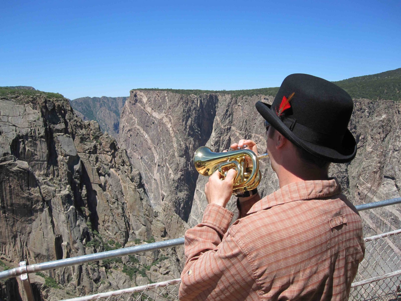
For the rest of the afternoon, we drove the road along the rim stopping at each overlook along the way. I enjoyed playing the trumpet across to the visitors on the south rim lookouts; I’ve been ruining wilderness experiences since 1982. We ate our lunch huddled under one of the few pinyon pine trees that we could find. Natural shade is not a common phenomenon in these parts of Colorado.

A Little Bit of Dixieland
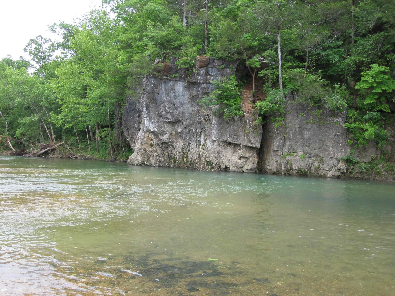
The Same View Without Trumpet...

Easing on down the road, we made our destination to be Ridgway State Park, which was at the crossroads of Ouray and Telluride. We set up camp for the next two nights intending to explore these towns over coming days.

Driving into Ouray, we weren’t sure what to do. We walked up the street, down the street and finally headed to cascade falls, which is accessible from the town. Admiring the high falls, we decided that we needed a longer hike for the day.

We stopped in at the visitor center where the Ouray perimeter trail was recommended to us. It was a five-mile trail, which took us along the cliffs that surround the old mining town. We were taken to the top of cascade falls and along a suspension bridge over a slim box canyon. Just as we were getting tired, we ended up back in town where we stopped in O’Brien’s Pub for a bite.


After lunch we went to the Bachelor-Syracuse mine for a tour. We walked along the tracks into the old silver mine and learned about the terrible working conditions associated with mining, especially in the late nineteenth century. It made us appreciative of the way that we earn our living because we didn’t die of rock-lung at the age of twenty-five. Interestingly there are two mines that may be opening back up in Ouray.


In the evening, we attended a “talk” on “geology” which turned out to be someone showing pictures of their hikes around Ouray. The “talk” contained no actual geology. It was a bright night back at Ridgway State Park because of the full “super-moon” which was supposed to appear closer to the Earth than a normal full moon.

In the morning, we packed our tent and headed toward Telluride where we were told to park in the mountain village. We did as told and got a shady spot in the parking garage. Since our car was at the ski resort, we got to ride the free gondola into downtown. Apparently it is the only public transportation of its kind in the United States.

We got to Telluride on the last day of the Bluegrass Festival and after looking at the lineup for the day, we were determined to get in. We found two guys selling tickets since they had to drive home and we headed for the gates. Since we have been traveling like hippies for the entirety of the trip, we figured that we may as well hang with hippies for the day.

As we entered the festival we sat behind a group dressed as pirates and enjoyed listening to Bela Fleck’s virtuosity on the banjo. At times it was hard to realize that he was playing the banjo and not something with more strings like a lute.

We took the gondola back to the car and got our seats and some snacks for the rest of the day where we got to listen to The Infamous Stringdusters, Natalie MacMaster and Donnell Leahy, Hot Rize, and Jackson Browne. It was an incredible lineup of high caliber musicians and at times the people watching were as eye popping as the stage show. At one point, there was an all-festival marshmallow fight. Oh to be back at UVM again…


Since we didn’t have a plan for camping for the night, we headed back to the car before the last act: the Telluride House Band. We were sad to miss it since it threw together many of the top acts of the festival to perform in an all-star bluegrass band. When we were driving out of Telluride, I flipped on the radio and was excited to hear that there was a live broadcast from the festival. We didn’t have to miss the last band at all!

We found a Bureau of Land Management campsite about twenty miles outside of Telluride and fell asleep listening to the last part of the festival on the radio. Our next stop will be Moab where we plan to explore Arches National Park.

Thursday, June 20, 2013

Crested Beauty

On top of one of the dunes, a girl from Denver suggested that we visit Crested Butte as one of the most beautiful places in Colorado. It was a few hours of driving which started as open prairie, and eventually became a windy mountain pass. Arriving in Gunnison, we grabbed some barbeque and headed north on the one road into Crested Butte.

As we approached, we could see that it was in fact a very beautiful place, on of the most picturesque that we’ve ever visited. Mount Crested Butte imposingly rises on the eastern side of town while higher mountains with snow in the peaks surround the area. We parked the car and walked down main street looking for something to do, and wandered into the Mountain Bike museum. It had a piano and we couldn’t help playing some ragtime!


It turns out that Crested Butte is the mountain bike capital of the west (or possibly the world). We rented some bikes, grabbed a trail map and headed off on some of the not-so-hardcore trails just outside of the town. We took a break and dipped our feet in the river, which was instantly numbing.


We decided to camp just outside of town where we found “Oh be Joyful,” a Bureau of Land Management site which was on a road that the prius could barely navigate due to the ruts and boulders. We set up camp in view of the snowy mountains and played some music before going to sleep early. Due to the chilly evening we set up the car for sleeping. Oddly enough, we were one of the few campers to have a roof over our heads. We soon noticed that many of the other people around us were setting up their sleeping bags on the ground….and the low was in the 30’s…..sheesh!

 
The next day, we awoke and hiked the “Oh be Joyful” trail towards two tall waterfalls. It required fording the numbing river, which I calculated to be at 32.000000001 degrees. Those with trucks and SUVs were driving across it. After gaining feeling back in our feet we hiked up to the waterfalls, wondering how this area was not a national park.


Waterfalls

After navigating back up the “road,” we headed to the ski town where we would hike through Snodgrass meadows and into the aspen groves. After crossing ten thousand feet in altitude we headed back to the car, huffing and puffing


After some music in the park, we went to Teocalli Tamale for burritos that should fill us up for days! I learned that their hot salsa was very hot as a turned bright red eating their burrito.

We’re headed in the general direction of Black Canyon of the Gunnison National Park, looking for a campsite for the night.

Wednesday, June 19, 2013

Dune it!

When we left Lamar, we decided to head directly to Great Sand Dunes National Park without distraction. Within an hour, we pulled into Bent’s Old Fort National Historic Site after seeing a sign on the road….so much for not getting distracted.

Bent’s Old Fort was a trading post on the border of Mexico before the Mexican-American war pushed that border to the Rio Grande. Americans, Mexicans and many Indian tribes including the Cheyenne and Pawnee used it. The National Park Service built a recreation of the fort, using blueprints and sketches of the original to guide them. We took a tour and realized that the trading routes of the fort would have connected to the Allegheny Portage Railroad in Pennsylvania!


After leaving the fort, we began driving on a road that seemingly went on forever, we watched an approaching thunderstorm for sixty miles before we arrived in Walsenburg. We managed to find some great Mexican cuisine and walked around the town to stretch our legs, and burn a tiny percentage of the calories from lunch, before getting on the road again.

We finally arrived in Great Sand Dunes National Park in mid-afternoon and immediately found a campsite. We set up camp and walked to Medano creek, just at the foot of the dunes, which can rise to 750 feet!


The next day, we awoke early excited to hike the dune field. We strapped on our hiking boots and when we got to the dunes we found ourselves in some of the most strenuous hiking that we have ever done for three reasons:

1)    Altitude: 8200’
2)    Sand makes footing tricky… imagine walking through an uphill beach…
3)    We’ve been sitting in a car for a week and are probably out of shape

We huffed and puffed our way to “high dune” which is the second highest dune in the park. The panoramic view gave us a great spot to enjoy our trail mix and visit with the other dune climbers. Eventually we made our way down, which was much easier and incredibly fun!


We relaxed for the rest of the day with games, food and music before going to sleep early.

The next morning, we hiked the overlook trail for a view of the dunes from the foothills of the Sangre de Cristo mountains. It gave us a breathtaking view of the immense dune field book-ended by the prairie on one side and the mountains on the other. We saw some friendly deer walking the trail with us on the way back.


Leaving the park, we couldn’t help but stop and gawk at the dune overlooks. We just crossed the continental divide on our way to Gunnison and Crested Butte where we may feel slightly less dehydrated in a slightly less arid environment!

Monday, June 17, 2013

Dust in the Wind

We did it. We managed to get up and drive across the last bit of Missouri, the entirity of Kansas and end up in Lamar, Colorado for the evening. It was a long day of driving with not much steering wheel involvement... We may have been able to get across the state with pedals only, something to try next time?

As we traveled, we compiled a video of some of the exciting activities that you can partake in while you are visiting Kansas:


The excitement for the day came at the tail end when we encountered a band of severe thunderstorms. We stopped at Porky's Parlor in Syracuse and watched the visibility reduce to the point that we couldn't see across the street. It turned out that the area has been suffering from drought and is getting dust storms similar to those of the dust bowl era. The rain and thunder did come, but the storm was unlike anything that we had ever experienced. After riding it out with chimichangas and enchildas we got on the road and drove into a beautiful sunset, finally arriving in Colorado!

We're on our way to Great Sand Dunes National Park for some dune surfing!

Saturday, June 15, 2013

Ozark Mountain Daredevils

While drifting off to sleep at Lake Wappapello State Park in southeastern Missouri we started to hear banjo picking in the distance. We slept well, despite the memories of ‘Deliverance’ flooding into our heads.


Our intention the next morning was to make our big drive across the prairie. We made it about sixty miles when we noticed a sign for the Ozark National Scenic River. It sounded enticing, so we stepped inside and inquired about what to do in the area. Once the ranger told us that we could rent a tube and float down the river, we were sold since it sounded better than spending the day in the car!

We drove to Eminence and found an outfitter with a double tube, packed some snacks and hopped aboard a school bus with twenty-seven other rafters, all from Memphis. It was mostly a relaxing float in between some problematic sections of the river that combined rapids with downed trees. There is really no mechanism to effectively steer a tube so we went with flailing. 

Bluffs along Jack's Fork River
Lisa, lounging with a snack


After our lazy day, we grabbed lunch in Eminence where we each ordered burritos. To our surprise they came deep fat fried, as would be the custom in the mid-west…

Tonight, we are staying at a hotel in Springfield due to inclement weather overnight. Tomorrow will be our drive across Kansas…unless we get distracted again.

Friday, June 14, 2013

My Old Kentucky Roam

Man, these Southerners really know how to strap on the feed-bag! After our last post we stopped at the Cantuckee Diner for a fried chicken buffet (I know! Kentucky Fried Chicken!) and languished back to the car for our drive to Abraham Lincoln’s Birthplace.

According to our observations, one of the biggest moral failures of Hodgenville, Kentucky is the commercialization of the birth of our 16th president. When we arrived at the National Memorial, we were surprised to an opulent staircase leading to a marble temple, which housed the bucolic cabin that we were expecting to see. I suppose that the juxtaposition did represent well the social ascension of Abraham Lincoln’s life. We filled our water bottles at the sinking spring, where Lincoln probably took his first sips of water.


After a short drive we were elated to enter Mammoth Cave National Park where we quickly snagged a campsite for the next two nights. After some stew, it was off to bed since we planned to spend the next day in the cave.

Our first spelunk of the morning was the “historic entrance tour,” which follows part of the tour that has been part of Mammoth Cave since 1816. As one of the first tourist destinations in the United States, it contains graffiti, which ranges from prehistoric to modern. The rooms seemed to go on endlessly, hence the name.. It turns out that Mammoth Cave is the longest cave system in the world, with over four hundred miles mapped and hundreds more possibly unmapped…


After a southern lunch (which is defined as any lunch that comes with a biscuit), we went to a program on the slave history of Mammoth Cave. Many of the early guides were slaves and some became famous for their skills. It would be a stretch to say that they were treated well, they were still slaves, but it was generally a better life than working agriculturally.

Our second descent into the cave was in the afternoon, where we went through the “new” entrance, which was blasted in 1921. Before Mammoth Cave was a National Park, there were multiple landowners vying for the best cave tours. This entrance was one of the few successes since it took tourists to a part of the cave which was not sandstone capped, allowing the water to percolate through and create cave formations known as Frozen Niagra.


We ended the day with a ranger program on cave art throughout the world. Lisa was excited to see art from Lascaux Cave in France where she had visited in 2000.

With no destination in mind the next day, we decided to head south to Nashville. We walked around music row, found some studios where Elvis had recorded. We enjoyed the clean look and shady avenues lined with magnolia trees. We ate another southern lunch with fried okra and collard greens at “The Row” before heading west. We had to get out before we developed coronary heart disease!


Our only other stop of the day was at Fort Donalson National Battlefield, which was a beautiful overlook on the Cumberland River. It was one of the earliest Union victories of the Civil War, allowing the acquisition of much of the supply lines in Tennessee. It’s not surprising that the Confederacy lost since their leader was named General Pillow, what a softee! We played all of the civil war songs that we could think of on our guitar and fiddle at the overlook and got back in the car to head west.


We are currently en route to Lake Wappapello in Missouri for the night where it looks like we will find more positive meteorological conditions for the evening. We just crossed over the confluence of the Ohio and Mississippi rivers! As we begin to leave the south, we’ve decided that this will cease to be a road-trip across ‘murica and begin to be a road trip across America!

Wednesday, June 12, 2013

Country Roads

--> Upon entering the “northway” in Westport, we were officially on the road and heading south. The interstate highways in New York were fairly uneventful until a stop at the Duanesburg  Stewart’s Shop where we had the best malted vanilla shakes that we have ever consumed, and we are connoisseurs of such things! We toasted Bill, Jill and Wolfjaw Killon with them and continued on I-88, eventually crossing onto the backroads of western Pennsylvania.


We picked Bald Eagle State Park off of the road atlas for our evening destination. We snaked through tiny hamlets and townships, finding our way to the park. There was no chance to see a bald eagle due to the pouring rain and we huddled under a pavilion to eat our Hormel chili (with a can of corn thrown in). Yes, it finally tastes like a road-trip!

Luckily, the rain cleared off at night and we could sleep in the car with windows open. We started our day with V-8 fusion and breakfast cookies (a big thank you to Mary-Ellen, Karen and Jean!) before leaving for the Allegheny Portage Railroad National Historic Site in off-and-on showers.

Walking into the historic site completely ignorant of what it may be, we soon learned that it was part of Pennsylvania’s canal system. The canal connecting Philadelphia to Pittsburgh was flawed due to the imposing Allegheny mountains in the way. Their solution was to build stationary engines on hills connected to rope-tows and drag the boats up and over the mountains. One has to appreciate the ingenuity and big engineering ideas as well as the industrious immigrant labor from the nineteenth century.


Heading south towards Johnstown, we found the Johnstown Flood National Memorial on the map. We headed into the visitor center fairly ignorant of the scale of the event. It turned out to be a mostly manmade disaster when an earthen dam gave way in 1889 and killed over two thousand people in the villages down-river. It was not exactly an uplifting stop, but an interesting piece of local history nonetheless.


We couldn’t find a picnic area, so we ended up pulling into a Wal-Mart parking lot to eat our chicken sandwiches for lunch. About halfway through our meal we noticed a “no loitering” sign. Lisa decided that as soon as you pull out a can opener, you’re loitering. Luckily the local authorities didn’t seem to notice…PHEW!

Since it was right down the road, we headed to another depressing national landmark: The Flight 93 Memorial. The memorial is as yet unfinished but seems well visited and still shows the missing trees from where the plane had crashed. It was the first national memorial that we have visited that recounts and event that we could remember from our lifetime.


After crossing briefly into Maryland and then entering West Virginia, we headed to Stonewall Jackson Lake State Park for the evening where we were the only persons tenting in a busy campground. We walked on the boardwalk and admired the rolling mountains of West Virginia – it is really a beautiful state. Dinner was salmon, beans and lemon-pepper pasta before we played some music and went to bed.


We are currently in Kentucky, heading towards Mammoth Cave National Park for the evening. It has taken us through Appalachia where we found “Bluegrass Breakdown” as the morning show on the local public radio station! There’s nothing like starting your day in the mountains of West Virginia with Orange Blossom Special coming through the speakers!

Monday, June 10, 2013

Wadhams to where?

After a full day of packing, and months getting the house ready, we are embarking on another road-trip. Our destination is across the great plains for the first time since 2010 - Colorado! On our last trip we felt rushed through Colorado and intend to spend more time and visit many of the places that we drove by on our first road trip. Of course, plans can change along the way. We could end up anywhere...


Since we were late to leave, it gave us a great excuse to spend the night with Kevin and Elizabeth in Wadhams, NY. They are great friends and fed us to the brim before we played some music and collapsed into bed. It also gave us an excuse to sleep in a bed for one more night before we would be camping.


After cleaning out Kevin and Elizabeth's refrigerator in the morning, we are packing up and heading south. Our first planned destination is Mammoth Cave National Park in Kentucky but I'm sure that we will meander through Appalachia and find some distractions along the way.