After our last update we stopped at the grocery store and picked up some chicken breasts for supper. We took them to the northern, least visited entrance to Zion National Park for an evening picnic at the Kolob Canyon. We stood in awe of the orange sandstone monoliths that we got to watch at sunset almost by ourselves. It was a great way to finish the day! We spent the night in Hurricane, Utah (don’t worry, it was calm...).
The next morning we headed into the south entrance of Zion and immediately found a campsite for the evening. We walked to the visitor center and boarded the shuttle to see the scenic points within the canyon. Our first stop was at the Court of the Patriarchs - three gigantic formations named Abraham, Isaac and Jacob.
We boarded the shuttle and stopped to hike the Emerald Pool Trails. The paths took us to three separate oases where water collects from the porous rocks. The sun was hot so we took a break in the shade at each one. We had to eat our snacks quickly due to an overzealous squirrel that had obviously been used to getting food from humans.
Heading back towards the valley floor, we stopped at the Zion Lodge for lunch at the restaurant. Two huge sandwiches later, we were ready for a couple hours of couch time.
We pressed on and went to Weeping Rock. The huge rock overhead featured hanging gardens and water dripping down onto the path. I stood under one of the “drips” to wet my hair and cool down in the hot and humid weather.
At the end of the shuttle line, we intended to hike into the Narrows but lightning and thunder changed our plans. We got on the shuttle and went to the Human History Museum for some inside time. During the ranger program that we attended, a rainstorm in the distance created a waterfall that lasted roughly ten minutes and then disappeared!
After coming back to our campsite, we decided that we needed to drive some of the east entrance road to see some of the famous formations within Zion NP. We drove through the mile-long tunnel and stopped at the Checkerboard Mesa for pictures. The landscape to the east is much different terrain than the valley itself.
We stayed the night and wanted to do some hiking, but the weather forecast contained too much lightning for us to feel comfortable climbing on bare rocks. After breakfast, we bid farewell to Zion and headed towards Las Vegas.
Hoover Dam was our first stop of the day. It was a beautiful piece of engineering surrounded by the most rude people that we had encountered yet on the trip. We ate lunch at the cafe and snapped some pictures of the dam but didn’t take a tour. We drove over the top of the dam since they are closing it to traffic later this year.
Skirting Las Vegas, we drove to Death Valley National Park in the afternoon. Our first stop was at an overlook of the area where it was 110 and breezy. It felt like being in a dryer. Our clothes certainly weren't dry after being out of the car for a few minutes though...
We stopped at the visitor center and then headed south to Badwater Basin, the lowest point in the United States. We were amazed to see water on the ground when the thermometer in the car was now reading 120!
Driving north through the park, we drove the Artist’s Loop and stopped to view the sand dunes. As expected, it was too hot to spend any significant amount of time out of the car.
We headed out of the park and stopped at a campground on the way to Sequoia and King’s Canyon National Parks. We’re hoping that forest fires don’t impede our plans!
Wednesday, July 28, 2010
Sunday, July 25, 2010
DETOUR!
After waking up refreshed and showered at the KOA, we headed north to Cedar Breaks National Monument. Our first impression when we saw the amphitheater was that it was like a miniature Bryce Canyon. It had the the same orange rock and some of the white capstone. It also had a purple manganese layer near the top of the formations.
We drove the scenic drive, stopping at all of the available overlooks before hiking the Alpine Pond Trail with a ranger. The hike brought us through much of the wilderness areas and eventually to a small, shallow, spring-fed pond. Surprisingly, the pond had foot-long trout swimming in it.
After the hike we had a picnic near the campground (beef stew) and attended another ranger program on mountain lions. Apparently we can witness many of the wild behaviors of mountain lions by watching Pumpkin. I always suspected that he was a savage, feral, undomesticated beast. I miss him.
We hiked the Ramparts Trail to Spectra Point. The trail had some steep cliffs which gave Lisa sweaty palms. The point gave a beautiful view of the amphitheater and we could even see some snow in the canyon.
Leaving Cedar Breaks, we headed to Cedar City which was to the west. Our intention was to head south to Zion National Park but knowing how crowded it would be on the weekend, we plugged Great Basin National Park into the GPS and found out that it was only two hours away! We headed north to a park we both knew nothing about.
The drive was beautiful and took us through mountain passes and valleys with no human activity in sight. We passed four cars in the two-hour drive!
Great Basin National Park exceeded our expectations. The park itself isn’t a basin at all - it is a picturesque mountain range with a cave underneath. The basin refers to the area in northern Nevada in which water is trapped and doesn’t actually flow to the ocean. Instead it tends to form salty lakes in the valley which dries up in the summer. Neat place!
We went to the Astronomy program in the evening, but clouds overhead kept the ranger from even getting a view of the moon.
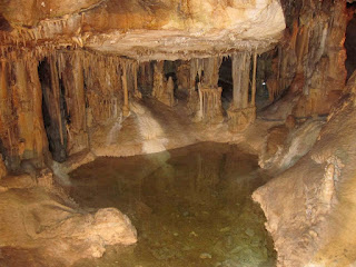
The next morning, we toured Lehman Caves (which is actually a misnomer - it’s just one cave). The cave was wetter than any other that we’ve visited on this trip and most of the formations are still active.
The cave’s famous formation is a “shield” which is a flat disk of calcite with vertical cylindrical-shaped patterns underneath.
We grabbed sandwiches at the visitor center and drove the Wheeler Peak scenic drive. The drive took us above ten-thousand feet and gave Lisa sweaty palms again. At the end of the road we hiked to the bristlecone pine grove which had gnarly trees that were two to three thousand years old! The trees looked ancient and their bark was smooth. The oldest tree in the world, nicknamed Promethius, was accidently cut down in this area in the 1960’s. Since then, there has been an older tree discovered, but the park service keeps it a secret so people don’t carve their names into it.
After the pine grove, we hiked to Teresa Lake, a small glacial pond that sits under the peak of the mountain. The water was cold, but there was a family there determined to swim, they must be cold-blooded.
Now that it’s Sunday night, were heading south to Zion National Park for the evening...probably
Saturday, July 24, 2010
Canyon de Chelly
We pulled into Canyon de Chelly Campground around 5:00, excited to be done driving early for the day! Our first task was to play “appletters” on the picnic table. Just before we started our first game, a ranger came over and told us about the evening program at the visitor center. After a few games, we headed to the program on the history of corn and the Navajo culture. Afterwards, we played a game of cribbage and went to bed.
In the morning we decided to do the south rim drive and hike the White House Trail (the only trail that you could hike without a Navajo guide). We enjoyed the overlooks of red-rock formations and miniature Mesa Verde style cliff dwellings. The trail brought us to a dwelling named “white house” because the rocks in the upper building had been bleached. After the Spider Rock lookout (the last on the south rim), we headed north.
We drove for most of the rest of the day with a stop for lunch at the Blue Coffee Pot Cafe for lunch; it was our third day of Mexican lunch in a row! We drove through part of Monument Valley, Glen Canyon/Lake Powell and Grand Staircase Escalante National Monument. It was a beautiful drive, but we were ready to quit as soon as we entered Utah. Like a mirage, a KOA appeared on the road in Glendale, meaning that we could take showers after being in the sun for three days! Chicken soup for dinner and we headed to bed. We’ll be heading to Cedar Breaks National Monument in the morning!
Thursday, July 22, 2010
Caves, Deserts and Petroglyphs
Our Tuesday morning started by descending through the natural entrance into Carslbad Caverns. It was the spot that the plethora of bats had flown out of the night before. After getting overheated, we were happy to spend the morning in a cave that constantly stays at fifty-six degrees, year round!
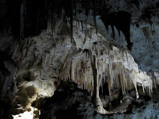
The natural entrance took us down a series of switch-backs on a paved trail. We were one of the first visitors to enter the cavern that morning and enjoyed the silence. We saw some formations on the way down but were in awe when we arrived in the Big Room. That area is the equivalent of six football fields and contains extensive formations. Carlsbad Caverns is unique in that it formed from sulfuric and carbonic acid, rather than from flowing water - the result is the larger spaces!
After walking through the Big Room, we grabbed a sandwich at the underground cafeteria and went on the ranger-led Kings Palace Tour. It had even more stunning stalactites, stalagmites, columns, soda straws and popcorn than the other areas of the cave.
After the tour we ate a can of soup that Lisa had the foresight to leave on the dashboard of the car that morning. It was piping hot; we had to wait for it to cool...
Our next destination was farther away than we thought, but we arrived at White Sands National Monument around 5:00. The locals bring sleds and slide down the dunes, very entertaining! It looked like a blast but we didn’t buy a sled so we had to settle for hiking the dunes.
We made dinner at the picnic area (chicken chow mein - yum!) and then went on the sunset stroll, a ranger-led geology and ecology talk. We learned White Sands was formed by gypsum eroding from the nearby mountains and being deposited into a lake that dries up part of the year. When the water is absent, the gypsum is subject to wind erosion and over time has blown into the area where the dunes are currently. Hence, white sand dunes.
"Sunset":
Clouds were blocking the sunset, so we headed north to find a campsite. We ended up driving on a dirt road for fifteen miles (not exactly sure we were heading in the right direction the whole time) before we found the Three Rivers Campground. The stars were amazingly clear there!
After some oatmeal the next morning we went to Three Rivers Petroglyphs (fifteen miles back on the awful dirt road). It was a Bureau of Land Management site with a trail that wound through ancient petroglyphs. It was quite a difference from the National Park Service sites in which you need binoculars to look closely at the glyphs!
We had been listening to some of the Mexican radio stations for the past few days and were in the mood for Mexican food. We stopped at a restaurant in Belen, New Mexico and each ordered the special. Delicious!
We made a brief stop at Petroglyph National Monument in Albuquerque. We took one loop trail to the top of a volcanic mesa and a few spurs. Unfortunately the heat emanating from the black rocks made us want to get back in the air-conditioned car! We especially liked the macaw:
Our last stop of the day was at El Morro National Monument, a historic trail stop through prehistory since it features a natural pool of water. Ancient Puebloans, Spanish Conquistadors and American settlers have carved their names and messages into the monument throughout history making for an interesting tapestry of pictures, messages, and graffiti. We camped at El Morro amidst a thunderstorm.
At the "natural oasis:"
In the morning, we hiked the larger loop trail at El Morro to the Pueblo at the top. It was a wonderful hike and the elevation kept the temperature around eighty! We also met a ranger that gave us some history of the area.
We're in Gallup, New Mexico, about to head west towards Canyon de Chelly National Monument for the evening.
Monday, July 19, 2010
Too Darn Hot...
I know, I know...we're in the southwest in July, what should we expect, right? I don't care if it's a dry heat, 110 is HOT...
We're back on the road. Heading south from Sedona, we skirted Pheonix to the east to visit Casa Grande National Monument. It was a series of Hohokam ruins which included a three story complex that represented the height of their building prowess. The construction material was a kind of natural cement, a mixture of pebbles, clay and sand that gave the site a much different appearance than many of the other ancient Indian sites that we've visited on this trip.
It's so hot in Arizona that even the buildings need to be in the shade:
At Casa Grande we took a couple Hershey's bars out of the air conditioned car for a snack - they were rock solid when we grabbed them but they melted into a messy puddle of mush within thirty seconds. Gross.
Our next stop was just west of Tucson at Saguaro National Park (West). We were impressed with the giant cacti as soon as we drove into Pheonix but were even more impressed by the sheer numbers of them within the park. We went to the visitor center and learned fun facts about the saguaros:
-A saguaro generally lives for 150-200 years!
-A saguaro can soak up to 200 gallons from a single rainfall!
-A full grown saguaro weighs about 16,000 pounds!
-A saguaro doesn't grow "arms" until it is at least 75 years old!
I especially enjoyed taking pictures of the dead saguaros, since their ribs would fan out towards the sky:
Lisa wanted to BE a saguaro:
Unfortunately it was too hot for us to hike on any of the trails in the park. We headed to Tucson to visit my cousins Gret, Kim and Melissa as well as my aunt Helen. We were treated to some great company as well as a delicious chicken dinner! Melissa even sent us off with an extensive care package when we left (the chocolate covered peanuts didn't last long...).
There was a long drive ahead of us to Guadalupe Mountains National Park in northern Texas. Much of the mountain range is a fossilized coral reef - the result of an uplifted ancient shallow sea bed. It was too hot to hike again so we ended up chatting for a while with a ranger that just finished at Marlboro College in Brattleboro.
The slight green in the mountains was a welcome change after the desolation that we spent the morning driving through:
We reached our goal for the day when we arrived at Carlsbad Caverns National Park in the evening. We made it in time for the evening bat flight! No electronics were allowed at the amphitheater so we don't have any pictures. It was amazing watching 300,000 bats fly out of the cave and off into the horizon; they looked like a black cyclone as they swirled out of the cavern.
Time for bed since we'll be going into the cave just after the bats get back in...
Sunday, July 18, 2010
Petrified Trees and Pueblos
After a pretty lazy day yesterday, we got up early this morning and headed northeast of Sedona with three destinations in mind. It felt funny heading east since we've been driving either west or south for a month now...
Our first stop was Walnut Canyon National Monument. It was another ancient Sinagua site with small cliff dwellings. The cliffs were formed by eroding limestone and the ancient people took advantage of the area. We hiked the Island Trail which went right up to some of the ruins and offered a good view of many of the others. We were happy to do it early since it was steep! The rim trail was closed for the summer so we headed further east.
The second destination was Petrified Forest National Park. We came in the southern section and hiked among many of the giant petrified logs. We found ourselves pointing to the interesting colors emanating from the log shaped rocks. It certainly fit our notion of the National Parks as National Oddities. We then went to view petroglyphs at Newspaper Rock and Puerca Pueblo.
Our last stops at Petrified Forest were the overlooks of the painted desert which looked mostly pink in the afternoon sun.
We met Amy and Tom at our last stop of the day, the Meteor Crater. It was a well preserved massive hole in the ground from the impact of a meteorite. There was a human sized astronaut at the bottom that we couldn't see with the naked eye but could with binoculars! Just like the grand canyon, it was easy to lose the scale without something to compare it to!
On the way back we decided to drive through Winona, Arizona...it was just a few modular houses and a closed bridge. We couldn't even take a picture of a sign!
Tonight is our last night in Sedona, but tomorrow we're heading south for Casa Grande and Saguaro National Park.
Friday, July 16, 2010
Grand Canyon (from the south rim)
We woke up early so that we could drive to the south rim of the Grand Canyon before the roads were too crowded. We ended up at the south rim at 9:00 and hopped on the shuttle towards the Grand Canyon Village. Even though we were early, the bus was still filled to the brim!
Our first stop was the "rim walk," a ranger-led geology program that followed a portion of the Rim Trail. We enjoyed the talk and tried our best to stay in the shade with the one-hundred degree heat! We got to see a California condor floating on updrafts from the canyon. The ranger told us that there are only 180 wild birds worldwide!
Hungry, we headed back towards the lodge where everyone was standing outside. It turns out there was a fire-alarm so we waited outside the "Arizona Room." Once everyone went back in, we were the first to get a table with a view of the canyon. We had identical meals: roasted red pepper soup and beef brisket - yum!
We walked the rim trail and a portion of the Bright Angel Trail but the heat (and smell of baking mule dung) kept us from descending too far into the canyon. We went back for a great ranger-led history talk on early impressions of the Grand Canyon. It was more story-telling than history.
Driving out through the eastern road, we stopped at many of the overlooks, including the watchtower at Desert Point! We took more pictures than we'll ever need realizing that the Grand Canyon is just too big to capture with a camera...
Wednesday, July 14, 2010
Everything's RUINED!
We met Kim, Gret and Helen again this morning for a smorgasbord of breakfast. Their house in Oak Creek was beautiful and even had a grand piano! We enjoyed catching up and then ate our fill of delicious eggs, bacon, English muffins and strawberries. Delicious!
Around noon, we headed to Montezuma's Castle National Monument. The castle is a cliff dwelling similar to those at Mesa Verde. The settlers of the region assumed that it was Aztec in origin - hence the name. However it was part of a culture named the Sinagua that disappeared mysteriously around the year 1400. We hiked out to view the castle with our umbrellas for shade and they became doubly useful when it started to downpour!
After a couple stops at dumpy antique stores (the best kind), we headed to Tuzigoot National Monument. It was another ruin from the Sinagua people but was completely different from Montezuma's Castle in that the paths went through the dwelling itself. It looks like an ancient sprawling apartment building. Our umbrellas kept inverting there because of heavy winds!
On our way back to Sedona, we stopped at a shoddy looking army surplus store where we found a pair of great binoculars for twenty-three dollars! It was perfect since we're heading to the south rim of the Grand Canyon tomorrow!
Tuesday, July 13, 2010
Sedona!
Our first day in Sedona was the antithesis of the trip so far. The goal was not to get in the car all day! Our leisurely day just included some time swimming and games. We also explored uptown (that's what they call it...) Sedona and found a shop where we could get orange-chocolate fudge. It was a good day; we're enjoying being spoiled with luxuries like running water and electricity.
The pace has been a bit slower:
We woke up the next morning and went to Red Rock State Park, just about ten miles down the road. The park had beautiful views of the rock formations that surround the Sedona area. We hiked the Eagle's Nest trail to an overlook of the park and followed the perimeter to a bridge over Oak Creek. We admired all of the healthy sycamores that surround the water.
After a picnic at the park, we headed back to Sedona for the afternoon for more swimming and games. We met my cousins Kim, Gret and Aunt Helen for supper at the Hideaway. It was great catching up, we haven't seen them since the wedding. The food was great and we're both set for lunch tomorrow, yum!
Sunday, July 11, 2010
One BIG Hole in the Ground...
Our first stop was at Pipe Spring National Monument, just over the Arizona border. It was a clash of cultures site where Mormon pioneers created a ranch on land used by the Paiute Indians. Touring the "Winsor Castle" brought us to a room with a cheese-making facility. Lisa was in her glory (with her "sweet dreams are made of cheese" shirt):
Upon arriving at the North Rim of the Grand Canyon, we saw the word "deli" on the way to the lodge. After getting our first views of the canyon's depths from the paths surrounding the lodge, we got big sandwiches (polish sausage for Chris, portabella mushroom for Lisa). We were just in time for a ranger-led geology seminar on the formation of the layers within the canyon.
We took the Cape Royal Road, stopping at the overlooks and taking some of the short hikes to views that didn't (but SHOULD have) had a fence at the edge of the canyon. We also took a path to an ancient Pueblo. It used to take the natives two days to walk from the rim to their farms next to the river, on the canyon floor.
At the end of the trail, we met a couple from Georgia that were kindred spirits to Lisa's parents. Very funny people and great accents! Unfortunately, the campground was full so we headed out of the park and camped at De Motte - just north of the rim.
Up early again - we took the long road around the canyon to Wupatki National Monument. The Pueblos were similar but better preserved than those at Hovenweep. We stopped at three sites to tour the ruins. Our favorite was the Wupatki Pueblo which was a sprawling fortress with a ball-field below.
Our next stop on the loop was Sunset Crater National Monument. It was the site of a massive volcanic eruption around the year 1050. The cinder created fertile soil for the people at Wupatki. We stopped at some overlooks and took pictures but thunder overhead kept us from getting on the trails.
We headed south-west to Sedona, Arizona - our base camp for the next week (thanks Ma & Pa)! We'll be spoiled with access to electricity and running water!
Saturday, July 10, 2010
"It's a Hell of a Place to Lose a Cow..."
That was Ebenezer Bryce’s response when asked about the beauty of the surrounding canyon...
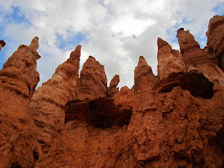
Driving into Bryce Canyon National Park we decided to park our car and ride the shuttle to many of the most scenic spots. The aptly-named Bryce, Inspiration, Sunset and Sunrise Points allowed us to gawk at the orange and white creamsicle-colored spires and rock formations below our vantage points. We stopped for popsicles at the general store and ate them quickly while a dark thunderhead started to roll in.
We took the scenic drive to Ranbow Point and Yovimpa Point. We couldn’t help taking dozens of pictures of the brightly-colored formations. Meandering our way back through the overlooks resulted in even more pictures, but another dark cloud speeded our return trip.
After supper, we attended “Star Stories” an evening program on constellations and the seasonal location of stars. It was featured as part of Bryce’s “Astronomy Week.” We didn’t stay up for much of the stargazing before we fell asleep around 10:00.
We woke up at 5:30 and quickly packed the car to go to Bryce Point for sunrise. We found ourselves among a Japanese tour group but enjoyed the orange light on the formations despite the crowd. There were just enough clouds in the air to reflect the light as pink and red.
Since it was cool and early, we hiked the Queen Victoria Trail, which connected to the Navajo Trail loop. It took us through many of the hoodoos and rock formations. Since we were starting from 8,000 feet above sea level we huffed and puffed on the hills. We deemed it one of the best hikes that we’ve been on this trip.
Hoodoos:
On the trail:
Leaving Bryce, we found a diner for a Grand-Slam Breakfast! We stuffed ourselves and are now on our way to the north rim of the Grand Canyon.
Subscribe to:
Posts (Atom)